 Catalogue PIGMA
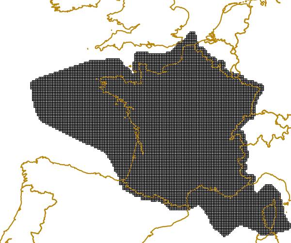
/Métropole/Méditerranée occidentale
Type of resources
Available actions
Topics
Keywords
Contact for the resource
Provided by
Years
Formats
Representation types
Update frequencies
status
Service types
Scale
Resolution
-
Mediterranean and Black Sea fisheries feature a great variety of target species, vessels and fishing gears and play an important socioeconomic role in the whole region. The mandate of the General Fisheries Commission for the Mediterranean (GFCM) is to ensure the sustainability of fisheries activities through the adoption of adequate management measures. The assessment of the size and state of the stocks exploited by fisheries is one of the pillars of modern management. The GFCM as the responsible Regional Fisheries Management Organisations (RFMO) of the Mediterranean and Black Sea has established permanent working groups on dermersal and small pelagic fish species where fisheries scientists perform their analysis and provide the best scientific advice to better manage fisheries and fish stocks. The groups, in cooperation with regional programs under the Regional Sea Conventions, set standards and guidelines for the collection, transmission and analysis of these data.
-
LaCoast is a research project undertaken in the mid 1990 under the lead of the Joint Research Centre (JRC) and aimed at quantifying the changes of land cover types in a 10 km land strip from the coastline. LaCoast uses CORINE Land Cover version 1990 as its reference dataset and track differences of land cover changes using LANDSAT satellite images from the mid-1970's.
-
The EEA coastline for analysis is created for highly detailed analysis, e.g. 1:100 000, for geographical Europe. The coastline is a hybrid product obtained from projects using satellite imagery as data source: EUHYDRO (https://land.copernicus.eu/imagery-in-situ/eu-hydro) and GSHHG (http://www.soest.hawaii.edu/pwessel/gshhg/). The defining criteria was altitude level = 0 from EUDEM (https://land.copernicus.eu/pan-european/satellite-derived-products/eu-dem/view). Outside the coverage of the EUDEM, the coastline from GSHHG was used without modifications. A few manual amendments to the dataset were necessary to meet requirements from EU Nature Directives, Water Framework Directive and Marine Strategy Framework Directive. In 2015, several corrections were made in the Kalogeroi Islands (coordinates 38.169, 25.287) and two other Greek little islets (coordinates 36.766264, 23.604318), as well as in the peninsula of Porkkala (around coordinates 59.99, 24.42). In this revision (v3, 2017), 2 big lagoons have been removed from Baltic region, because, according to HELCOM, are freshwater lagoons.
-
Coastal zones are presented as a series of 10 consecutive buffers of 1km width each (towards inland). For this dataset, were treated as sea data all areas with class values of 52x (521: coastal lagoons, 522: estuaries, 523: sea and ocean) in Corine Land Cover (details in lineage).
-
Coastal zones are presented as a series of 10 consecutive buffers of 1km width each (towards inland). For this dataset, were treated as sea data all areas with a class value of 523 (sea and ocean) in Corine Land Cover (details in lineage).
-
Coastal zones are presented as a series of 10 consecutive buffers of 1km width each (towards inland). For this dataset, were treated as sea data all areas with a class value of 523 (sea and ocean) in Corine Land Cover (details in lineage).
-
Coastal zones are presented as a series of 10 consecutive buffers of 1km width each (towards inland). For this dataset, were treated as sea data all areas with class values of 52x (521: coastal lagoons, 522: estuaries, 523: sea and ocean) in Corine Land Cover (details in lineage).
-
The EEA coastline dataset is created for detailed analysis with a Minimum Mapping Unit of e.g. 1:100000, for geographical Europe. The coastline is a hybrid product obtained from satellite imagery from two projects: 1) EUHYDRO (Pan-European hydrographic and drainage database) [https://land.copernicus.eu/pan-european/satellite-derived-products/eu-hydro/view] and 2) GSHHG (A Global Self-consistent, Hierarchical, High-resolution Geography Database) [http://www.soest.hawaii.edu/pwessel/gshhg/]. The defining criteria was altitude level = 0 from EUDEM [https://land.copernicus.eu/pan-european/satellite-derived-products/eu-dem/view]. Outside the coverage of the EUDEM, the coastline from GSHHG was used without modifications. A few manual amendments to the dataset were necessary to meet requirements from EU Nature Directives, Water Framework Directive and Marine Strategy Framework Directive. In 2015, several corrections were made in the Kalogeroi Islands (coordinates 38.169, 25.287) and two other Greek little islets (coordinates 36.766264, 23.604318), as well as in the peninsula of Porkkala (around coordinates 59.99, 24.42). In this revision (v3, 2017), 2 big lagoons have been removed from Baltic region, because, according to HELCOM, are freshwater lagoons. This dataset is a polygon usable as a water-land mask.
-
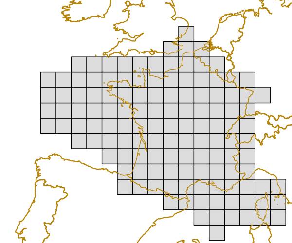
The grid is based on proposal at the 1st European Workshop on Reference Grids in 2003 and later INSPIRE geographical grid systems. The sample grid available here is part of a set of three polygon grids in 1, 10 and 100 kilometres. The grids cover at least country borders and, where applicable, marine Exclusive Economic Zones v7.0, http://www.marineregions.org. Note that the extent of the grid into the marine area does not reflect the extent of the territorial waters.
-
The grid is based on proposal at the 1st European Workshop on Reference Grids in 2003 and later INSPIRE geographical grid systems. The sample grid available here is part of a set of three polygon grids in 1, 10 and 100 kilometres. The grids cover at least country borders and, where applicable, marine Exclusive Economic Zones v7.0, http://www.marineregions.org. Note that the extent of the grid into the marine area does not reflect the extent of the territorial waters.